Artificial salt marshes: from satellite screening to field interventions
Artificial salt marshes: from satellite screening to field interventions
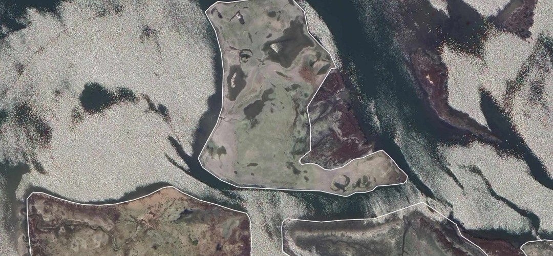
The artificial salt marshes in the Venetian Lagoon do not all evolve in the same way. This is the finding of a new study published in Restoration Ecology, which, for the first time, systematically assesses the 63 morphological reconstructions in the central Malamocco basin using high-resolution satellite imagery.
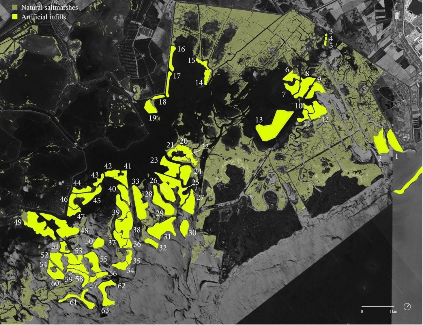
The study, carried out by researchers from Wageningen University, the University of Antwerp, We are here Venice and DEME Group, examines part of the morphological restoration programme dating from the late 1980s. Over this period, over 1,600 hectares of mudflats and salt marshes were rebuilt using sediment dredged during the maintenance of navigable canals and infrastructure works. It was expected that these structures would be colonised spontaneously by vegetation and develop characteristics similar to those of natural salt marshes, but this has not always been the case. Furthermore, there has never been a comprehensive overview to compare their status and evolution on a large scale.
The researchers developed a screening methodology based on open-source satellite images (30 cm resolution), processed using GIS tools. For each of the 63 salt marshes, they analysed vegetation cover, the density of tidal channels and the ratio of emerged to submerged surface area.
The results show very wide variability amongst the different reconstructed salt marshes, even though they were built according to similar criteria and within the same regulatory framework. Their evolution does not follow a uniform pattern. However, the indicators analysed do not, on their own, capture the ecological complexity of these environments: aspects such as biodiversity, nutrient cycling and carbon sequestration cannot be directly detected from satellite imagery.
One particularly interesting finding concerns the shape of the salt marshes. Those with a more regular and compact shape tend to have greater vegetation cover, probably because they have a smaller proportion of their edges exposed to erosion and wave energy. The shape chosen at the design stage can therefore influence the way a salt marsh develops, even many years after its construction.
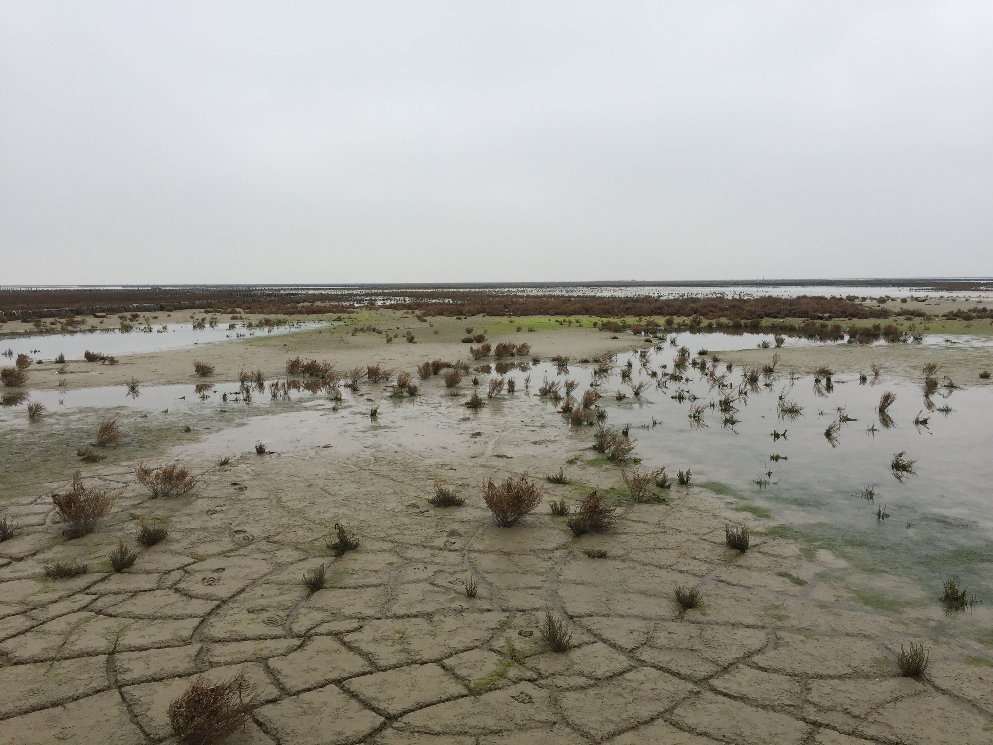
The study also provides a spatial database designed to facilitate comparisons between different sites and to track changes in the salt marshes over time, helping to identify the most vulnerable areas and guide restoration and maintenance work.
It is in this context that the fieldwork carried out by We are here Venice as part of the European WaterLANDS project fits in. To complement large-scale morphological reconstruction works, the project demonstrates the feasibility of nature-based solutions, including fascines to protect against erosion and the planting of native species and small, self-organised tidal channels, via openings created at strategic points around the nourishment containment perimeter.
The aim is to monitor the development of the infills and to intervene in vulnerable areas or as a preventative measure, thereby improving, over time, the resilience of the interventions, the reuse of sediments and the overall health of the lagoon ecosystem.
Footnotes:
All images are taken from: Chouairi et al. (2026). The cover image is adapted from Figure 3A of the original article.
References:
Chouairi, A., Meire, P., Gastaldi, A. M., De Keuleneer, F., & da Mosto, J. (2026). Evaluating the state of constructed infills in the Venice Lagoon through remote satellite imagery. Restoration Ecology. https://doi.org/10.1111/rec.70534
◾