Evaluating Inundation Dynamics through Timelapse Images and Machine Learning
Evaluating Inundation Dynamics
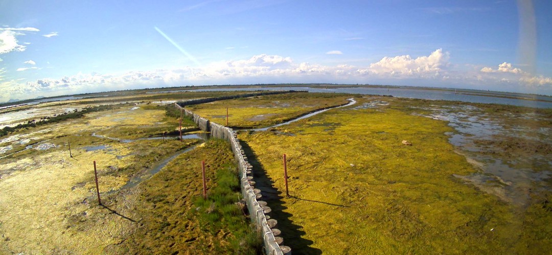
Over the past months, Vital has been collaborating with a research student, Ryan Bañares, as a part of the European Masters programme in Coastal and Marine Engineering and Management (CoMEM+) to explore innovative ways of monitoring surface water dynamics within our project sites. This is an important aspect affecting the viability of plant colonies and associated biodiversity.
A growing network of time-lapse cameras designed to capture both surface water dynamics and vegetation evolution within artificial salt marshes was established by Vital in 2023. There are now seven cameras in 3 different sites.
A central part of this approach is development of an automated system to convert the hours of footage into meaningful information about conditions on each marsh. Ryan’s research, supported by our technical partner DEME, involved applying a re-trained machine learning model (AQUANET) to the images collected throughout the monitoring campaign to automatically classify key features such as land, water, and sky, enabling large sets of images to be processed efficiently. This not only accelerates the analysis but also ensures consistent and objective interpretation of coastal dynamics—particularly inundation regimes.
An exciting direction of the study is the comparison of inundation dynamics between artificial and natural salt marshes. By examining how these different environments behave under similar conditions, the research sheds light on the relationship between inundation patterns and the growth of different halophyte species across our sites. These perspectives are especially valuable for guiding and accelerating the Vital Concept Design for Nature-based Solutions and wetland restoration practices.
This collaboration reflects Vital’s mission to connect scientific research with practical applications, ensuring that coastal communities and ecosystems can adapt effectively to ongoing change.
◾